
OSIL
Overview
The Open Space Imaging Lab (OSIL) mission is focused on providing hands-on satellite imaging experience to high school and university students in Rwanda. It demonstrates the capabilities of low-cost commercial off-the-shelf (COTS) imaging systems in a space environment while serving as an educational platform.
Through this mission, students are introduced to the fundamentals of Earth observation, orbital mechanics, and satellite operations, bridging theoretical learning with real-world space applications.
Concept of Operations
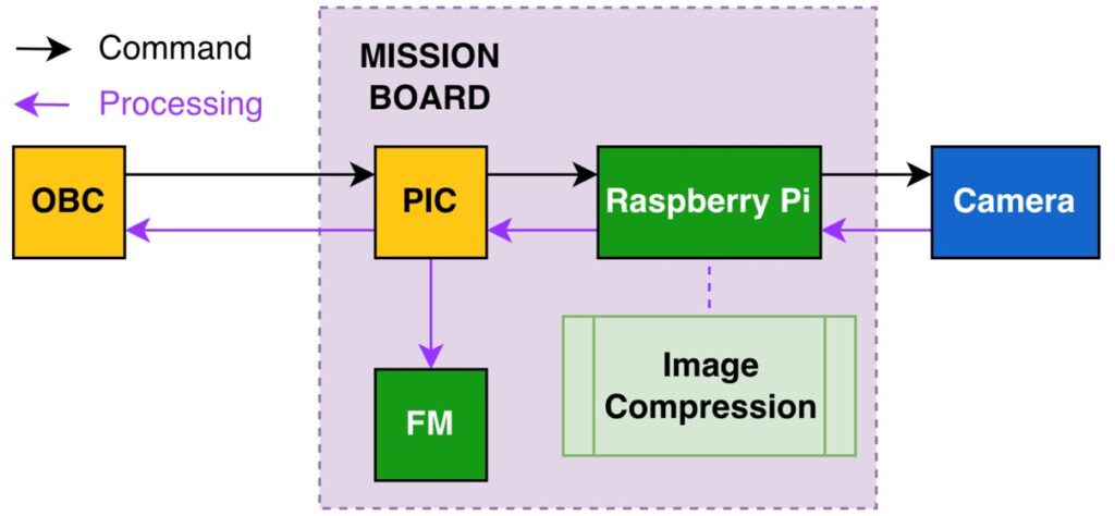
Basic Imaging Mode
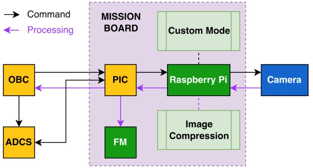
Default & Custom Target Imaging Mode
ML Imaging Mode
Design
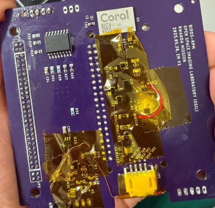
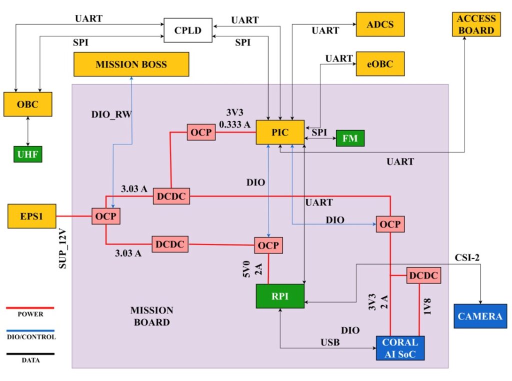
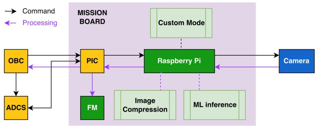
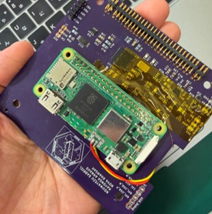
The OSIL payload is based on the Sony IMX219 sensor integrated with the Raspberry Pi Camera v2, providing a ground sampling distance (GSD) of approximately 2.32 km/pixel for a 1920-pixel-wide image. The system achieves a swath width of approximately 4448 km.
The architecture utilizes a Raspberry Pi Zero 2 W for onboard processing, running a lightweight machine learning model directly on the system.
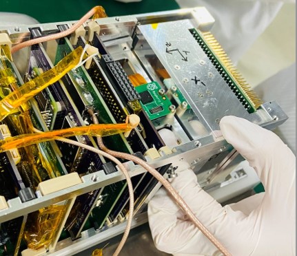
Testing
Testing of the OSIL payload included telemetry transmission to the OBC, data storage in onboard flash memory, and command-based image capture at different resolutions.
For onboard image classification, MobileNetV3 was selected as a lightweight model. An existing pre-trained model was initially tested, followed by additional training to improve classification accuracy for mission-specific categories, including cloud, land, ocean, night, and space.